Alertes en vigueurElkhart Golf Club, TX
SEVERE THUNDERSTORM WATCH 381 REMAINS VALID UNTIL MIDNIGHT CDTTONIGHT FOR THE FOLLOWING AREASIN TEXAS THIS WATCH INCLUDES 7 COUNTIESIN CENTRAL TEXASANDERSON FREESTONE HENDERSONLEON LIMESTONE ROBERTSONIN NORTH CENTRAL TEXASNAVARROTHIS INCLUDES THE CITIES OF ATHENS, BUFFALO, CALVERT,CENTERVILLE, CORSICANA, FAIRFIELD, FRANKLIN, GROESBECK,GUN BARREL CITY, HEARNE, JEWETT, MEXIA, NORMANGEE, OAKWOOD,PALESTINE, TEAGUE, AND WORTHAM.
Do not drive cars through flooded areas.Caution is urged when walking near riverbanks.Additional information is available at www.water.noaa.gov/wfo/FWD.
...The Flood Warning is extended for the following rivers in Texas...West Fork Trinity River Near Boyd affecting Wise County.West Fork Trinity River Near Jacksboro affecting Jack County.Trinity River Near Rosser affecting Ellis and Kaufman Counties.Trinity River At Dallas affecting Dallas County.Trinity River Near Long Lake (Oakwood) affecting Freestone,Anderson and Leon Counties....The Flood Warning continues for the following rivers in Texas...Trinity River At Trinidad affecting Henderson and NavarroCounties....The Flood Warning is cancelled for the following rivers inTexas...Chambers Creek Near Rice affecting Navarro County.* WHAT...Moderate flooding is forecast.* WHERE...Trinity River near Long Lake (Oakwood).* WHEN...From Monday morning until further notice.* IMPACTS...At 42.0 feet, Moderate flooding of numerous ranchesalong the river is expected. The Coffield Prison farm and ranchlands will be moderately flooded.* ADDITIONAL DETAILS...- At 8:30 PM CDT Sunday the stage was 33.8 feet.- Bankfull stage is 35.0 feet.- Flood stage is 35.0 feet.- Forecast...The river is expected to rise above flood stagetomorrow morning and continue rising to 42.4 feet earlyFriday afternoon. Additional rises are possible thereafter.
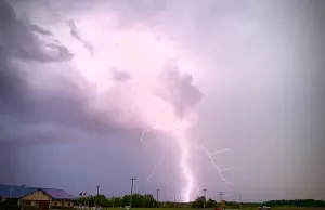
Torrential rainfall is also occurring with this storm and may leadto localized flooding. Do not drive your vehicle through floodedroadways.Frequent cloud to ground lightning is occurring with this storm.Lightning can strike 10 miles away from a thunderstorm. Seek a safeshelter inside a building or vehicle.A Severe Thunderstorm Watch remains in effect until midnight CDT forcentral Texas.
At 1012 PM CDT, Doppler radar was tracking a strong thunderstorm nearPalestine, moving southeast at 30 mph.HAZARD...Wind gusts of 50 to 55 mph and nickel size hail.SOURCE...Radar indicated.IMPACT...Gusty winds could knock down tree limbs and blow aroundunsecured objects. Minor damage to outdoor objects ispossible.This storm will remain over mainly rural areas of eastern AndersonCounty, including the following locations... Pert, Redtown, MoundCity, Salmon, Denson Spring, Cedar Creek, Crystal Lake, Slocum, ToddCity, and Neches.