Alertes en vigueurStreetman, TX
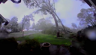
SEVERE THUNDERSTORM WATCH 224 REMAINS VALID UNTIL MIDNIGHT CDTTONIGHT FOR THE FOLLOWING AREASIN TEXAS THIS WATCH INCLUDES 10 COUNTIESIN CENTRAL TEXASANDERSON BELL FALLSFREESTONE HENDERSON LEONLIMESTONE MILAM ROBERTSONIN NORTH CENTRAL TEXASNAVARROTHIS INCLUDES THE CITIES OF ATHENS, BUFFALO, CALVERT, CAMERON,CENTERVILLE, CORSICANA, FAIRFIELD, FORT CAVAZOS, FRANKLIN,GROESBECK, GUN BARREL CITY, HEARNE, JEWETT, KILLEEN, MARLIN,MEXIA, NORMANGEE, OAKWOOD, PALESTINE, ROCKDALE, TEAGUE, TEMPLE,AND WORTHAM.
Do not drive cars through flooded areas.Caution is urged when walking near riverbanks.Additional information is available at www.water.noaa.gov/wfo/FWD.
...The Flood Warning continues for the following rivers in Texas...Trinity River At Trinidad affecting Henderson and NavarroCounties.Trinity River Near Long Lake (Oakwood) affecting Freestone, Leonand Anderson Counties.* WHAT...Moderate flooding is occurring and moderate flooding isforecast.* WHERE...Trinity River near Long Lake (Oakwood).* WHEN...Until further notice.* IMPACTS...At 45.0 feet, Major flooding of ranches and farm landsalong the river is expected. The Coffield Prison farm and ranchinterests will be flooded.* ADDITIONAL DETAILS...- At 2:30 PM CDT Thursday the stage was 43.7 feet.- Bankfull stage is 35.0 feet.- Flood stage is 35.0 feet.- Forecast...The river is expected to rise to a crest of 44.2feet early Saturday afternoon.