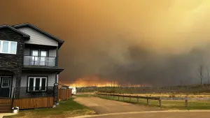
Alertes en vigueurShepherd, TX
Please report observed flooding to local emergency services or lawenforcement and request they pass this information to the NationalWeather Service when you can do so safely.Turn around, don't drown when encountering flooded roads. Most flooddeaths occur in vehicles.Motorists should not attempt to drive around barricades or drivecars through flooded areas.Additional information is available at www.weather.gov/hgx.Wednesday afternoon at 300 PM CDT.
...The Flood Warning continues for the following rivers in Texas...Trinity River near Crockett affecting Houston, Trinity, Walkerand Madison Counties.Menard Creek near Rye affecting Liberty, Hardin and Polk Counties.Trinity River at Liberty affecting Liberty County.Trinity River near Goodrich affecting San Jacinto, Liberty andPolk Counties.Trinity River near Moss Bluff affecting Liberty and ChambersCounties.Trinity River at Riverside affecting Trinity, San Jacinto, Walkerand Polk Counties.For the Trinity River...including Crockett, Riverside, Romayor,Goodrich, Liberty, Moss Bluff...Major flooding is forecast.For the Menard Creek...including Rye...Minor flooding is forecast.* WHAT...Moderate flooding is occurring and moderate flooding isforecast.* WHERE...Trinity River at Riverside.* WHEN...Until further notice.* IMPACTS...At 138.0 feet, Moderate lowland flooding continues withwater 3 to 4 feet below the State Highway 19 Bridge and PlantationDrive near FM 230 is inundated. FM 2978 is flooded and impassable.Up to one foot of water is flowing over Thomas Lake Road whichremains impassable. Several roads into the Green Rich Shores andDeep River Plantation subdivisions are covered with up to one footof water and homes in Deep River Plantation are threatened.* ADDITIONAL DETAILS...- At 8:30 PM CDT Tuesday the stage was 137.8 feet.- Bankfull stage is 133.0 feet.- Recent Activity...The maximum river stage in the 24 hoursending at 8:30 PM CDT Tuesday was 137.9 feet.- Forecast...The river is expected to rise to a crest of 138.2feet early Friday afternoon.- Flood stage is 133.5 feet.- Flood History...This crest compares to a previous crest of138.1 feet on 06/06/2015.- http://www.weather.gov/safety/flood