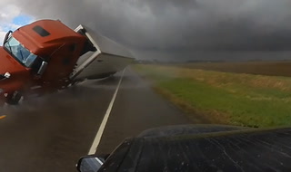
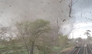
Alertes en vigueurMittie, TX
You should monitor later forecasts and be alert for possible FloodWarnings. Those living in areas prone to flooding should be preparedto take action should flooding develop.
* WHAT...Flooding caused by excessive rainfall continues to bepossible.* WHERE...Portions of Louisiana, including the following parishes,Bienville, Bossier, Caddo, Caldwell, Claiborne, De Soto, Grant,Jackson, La Salle, Lincoln, Natchitoches, Ouachita, Red River,Sabine, Union, Webster and Winn and Texas, including the followingcounties, Angelina, Cherokee, Gregg, Harrison, Nacogdoches,Panola, Rusk, Sabine, San Augustine, Shelby and Smith.* WHEN...From 1 AM CDT Thursday through Thursday evening.* IMPACTS...Excessive runoff may result in flooding of rivers,creeks, streams, and other low-lying and flood-prone locations.Flooding may occur in poor drainage and urban areas.* ADDITIONAL DETAILS...- A complex of showers and thunderstorms is expected to developthis evening over Central Texas, and quickly shift eastacross East Texas late tonight and into North Louisiana byand after daybreak Thursday. Locally heavy rainfall ispossible with these storms, with widespread rainfall amountsof one to three inches expected, with isolated higher amountspossible. Grounds remain saturated in wake of heavy rainfallthat fell Sunday night and Monday, with this additionalrainfall quickly running off and possibly resulting in flashflooding.- Http://www.weather.gov/safety/flood
Do not drive cars through flooded areas.Caution is urged when walking near riverbanks.Turn around, don't drown when encountering flooded roads. Most flooddeaths occur in vehicles.Caution is urged when walking near riverbanks.For more hydrologic information, copy and paste the following websiteaddress into your favorite web browser URL bar:water.weather.gov/ahps2/index.php?wfo=shvThe next statement will be issued Thursday afternoon at noon CDT.
...The Flood Warning is extended for the following rivers in Texas...Attoyac Bayou Near Chireno affecting San Augustine, Nacogdoches,Shelby and Rusk Counties....The Flood Warning continues for the following rivers in Texas...Angelina River Near Lufkin affecting Nacogdoches, Cherokee andAngelina Counties.For the Angelina River...including Alto, Lufkin...Minor flooding isforecast.For the Attoyac Bayou...including Chireno...Minor flooding isforecast.* WHAT...Minor flooding is occurring and minor flooding is forecast.* WHERE...Angelina River near Lufkin.* WHEN...Until further notice.* IMPACTS...At 165.0 feet, Expect flooding to continue for severaldays with the majority of the gravel access roadway flooded.Boaters and four wheel-operators should use caution traversingboth upstream and downstream on the Angelina River as currents canbecome swift and turbulent.* ADDITIONAL DETAILS...- At 11:30 AM CDT Wednesday the stage was 162.7 feet.- Bankfull stage is 158.5 feet.- Recent Activity...The maximum river stage in the 24 hoursending at 11:30 AM CDT Wednesday was 163.4 feet.- Forecast...The river is expected to rise to 163.9 feet Mondaymorning. Additional rises are possible thereafter.- Flood stage is 161.0 feet.- http://www.weather.gov/safety/flood