Alertes en vigueurLynchburg, TX
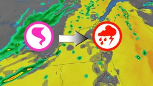
The National Weather Service has issued Severe Thunderstorm Watch342 in effect until 6 PM CDT this evening for the following areasIn Texas this watch includes 22 countiesIn southeast TexasAustin Brazoria BrazosBurleson Chambers ColoradoFort Bend Galveston GrimesHarris Houston LibertyMadison Matagorda MontgomeryPolk San Jacinto TrinityWalker Waller WashingtonWhartonThis includes the cities of Alvin, Anahuac, Angleton, Bay City,Bellville, Brenham, Brookshire, Bryan, Caldwell, Cleveland,Clute, Coldspring, College Station, Columbus, Conroe, Corrigan,Crockett, Dayton, Dickinson, Eagle Lake, El Campo, First Colony,Freeport, Friendswood, Galveston, Groveton, Hempstead, Houston,Huntsville, Lake Jackson, League City, Liberty, Livingston,Madisonville, Mission Bend, Missouri City, Mont Belvieu,Navasota, Old River-Winfree, Palacios, Pearland, Pecan Grove,Prairie View, Rosenberg, Sealy, Shepherd, Somerville, Stowell,Sugar Land, Texas City, The Woodlands, Trinity, Waller, Weimar,Wharton, and Winnie.
Turn around, don't drown when encountering flooded roads. Most flooddeaths occur in vehicles.Be aware of your surroundings and do not drive on flooded roads.
* WHAT...Urban and small stream flooding caused by excessiverainfall is expected.* WHERE...A portion of southeast Texas, including the followingcounties, Harris and Montgomery.* WHEN...Until 500 PM CDT.* IMPACTS...Minor flooding in low-lying and poor drainage areas.Ponding of water in urban or other areas is occurring or isimminent.* ADDITIONAL DETAILS...- At 149 PM CDT, Doppler radar and automated rain gaugesindicated heavy rain due to thunderstorms. This will causeurban and small stream flooding. Between 2 and 3 inches ofrain have fallen.- Additional rainfall amounts of 1 to 2 inches are expectedover the area. This additional rain will result in minorflooding.- Some locations that will experience flooding include...Pasadena, northwestern Baytown, Deer Park, South Houston,Bellaire, Humble, West University Place, Galena Park, JacintoCity, Jersey Village, Hunters Creek Village, Piney PointVillage, Aldine, Northside / Northline, Near NorthsideHouston, Greater Greenspoint, Greater Fifth Ward, GreaterHeights, Second Ward and Downtown Houston.- http://www.weather.gov/safety/flood