Alertes en vigueurFriendship, TX
THE NATIONAL WEATHER SERVICE HAS ISSUED SEVERE THUNDERSTORM WATCH225 IN EFFECT UNTIL 3 AM CDT FRIDAY FOR THE FOLLOWING AREASIN LOUISIANA THIS WATCH INCLUDES 6 PARISHESIN CENTRAL LOUISIANAAVOYELLES EVANGELINE RAPIDESIN SOUTHWEST LOUISIANAALLEN BEAUREGARDIN WEST CENTRAL LOUISIANAVERNONIN TEXAS THIS WATCH INCLUDES 4 COUNTIESIN SOUTHEAST TEXASHARDIN JASPER NEWTONTYLERTHIS INCLUDES THE CITIES OF ALEXANDRIA, BEAVER, BLEAKWOOD, BUNA,BUNDICK LAKE, BUNKIE, BURKEVILLE, CALL, COTTONPORT, DE RIDDER,EFFIE, FARRSVILLE, FIELDS, FORT JOHNSON, FRED, GIST, HILLISTER,HOLLY SPRINGS, IVANHOE, JAMESTOWN, JASPER, KINDER, KIRBYVILLE,LEESVILLE, LUMBERTON, MAGNOLIA SPRINGS, MAMOU, MANSURA,MARKSVILLE, MT. UNION, NEWTON, OAKDALE, ORETTA, PICKERING,PINEVILLE, REDDELL, SILSBEE, SIMMESPORT, SLAGLE, SPURGER,ST. LANDRY, TOWN BLUFF, VILLE PLATTE, WARREN, WIERGATE,AND WOODVILLE.
Do not drive cars through flooded areas.Caution is urged when walking near riverbanks.Turn around, don't drown when encountering flooded roads. Most flooddeaths occur in vehicles.Motorists should not attempt to drive around barricades or drivecars through flooded areas.For more hydrologic information, copy and paste the following websiteaddress into your favorite web browser URL bar:water.weather.gov/ahps2/index.php?wfo=shvThe next statement will be issued Friday evening at 930 PM CDT.
...The Flood Warning continues for the following rivers in Texas...Neches River At Rockland affecting Tyler, Angelina, Jasper andPolk Counties.Neches River Near Diboll affecting Trinity, Tyler, Polk, Angelinaand Houston Counties.Neches River Near Alto affecting Cherokee, Houston, Anderson andTrinity Counties.Neches River Near Neches affecting Cherokee, Houston and AndersonCounties.For the Neches River...including Lake Palestine, Neches, Alto,Diboll, Rockland...Minor flooding is forecast.* WHAT...Minor flooding is occurring and minor flooding is forecast.* WHERE...Neches River at Rockland.* WHEN...Until early Sunday morning.* IMPACTS...At 28.0 feet, Water will begin to flood severalsecondary roadways especially in the Fox Landing community.* ADDITIONAL DETAILS...- At 9:00 PM CDT Thursday the stage was 27.2 feet.- Bankfull stage is 28.0 feet.- Forecast...The river is expected to fall below flood stageSaturday morning and continue falling to 22.6 feet Tuesdayevening.- Flood stage is 26.0 feet.- http://www.weather.gov/safety/flood
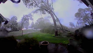
Prepare immediately for large hail and damaging winds. People outsideshould move to a shelter, inside a strong building and away fromwindows.Torrential rainfall is occurring with this storm, and may lead toflash flooding. Do not drive your vehicle through flooded roadways.
At 932 PM CDT, a severe thunderstorm was located near Rockland,moving east at 10 mph.HAZARD...Ping pong ball size hail and 60 mph wind gusts.SOURCE...Radar indicated. At 923 PM, Tyler County emergencymanagement reported quarter size hail on county road2925.IMPACT...People and animals outdoors will be injured. Expect haildamage to roofs, siding, windows, and vehicles. Expect winddamage to roofs, siding, and trees.Locations impacted include...Colmesneil and Rockland.