Alertes en vigueurCooper, TX
Please report observed flooding to local emergency services or lawenforcement and request they pass this information to the NationalWeather Service when you can do so safely.Turn around, don't drown when encountering flooded roads. Most flooddeaths occur in vehicles.Motorists should not attempt to drive around barricades or drivecars through flooded areas.Additional information is available at www.weather.gov/hgx.The next statement will be issued late tonight at 315 AM CDT.
...The Flood Warning continues for the following rivers in Texas...Trinity River near Crockett affecting Houston, Trinity, Madisonand Walker Counties.For the Trinity River...including Crockett, Riverside, Goodrich,Liberty, Moss Bluff...Major flooding is forecast.* WHAT...Minor flooding is occurring and minor flooding is forecast.* WHERE...Trinity River near Crockett.* WHEN...Until further notice.* IMPACTS...At 43.0 feet, Minor lowland flooding continues in thevicinity of the gage impacting ranching operations and prisonfarms. Livestock should be removed from low areas in the floodplain.* ADDITIONAL DETAILS...- At 8:45 AM CDT Thursday the stage was 44.2 feet.- Bankfull stage is 35.0 feet.- Recent Activity...The maximum river stage in the 24 hoursending at 8:45 AM CDT Thursday was 44.6 feet.- Forecast...The river is expected to remain steady above floodstage at 44.2 feet.- Flood stage is 41.0 feet.- Flood History...This crest compares to a previous crest of44.3 feet on 02/11/1975.- http://www.weather.gov/safety/flood
For your protection move to an interior room on the lowest floor of abuilding.
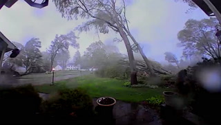
At 904 PM CDT, a severe thunderstorm was located near Trinity, or 16miles northeast of Huntsville, moving southeast at 30 mph.HAZARD...Two inch hail.SOURCE...Radar indicated.IMPACT...People and animals outdoors will be injured. Expect damageto roofs, siding, windows, and vehicles.Locations impacted include...Trinity and Riverside.