Alertes en vigueurCoady, TX
The National Weather Service has issued Severe Thunderstorm Watch237 in effect until 8 PM CDT this evening for the following areasIn Texas this watch includes 20 countiesIn south central TexasJacksonIn southeast TexasAustin Brazoria BrazosBurleson Chambers ColoradoFort Bend Galveston GrimesHarris Liberty MatagordaMontgomery Polk San JacintoWalker Waller WashingtonWhartonThis includes the cities of Alvin, Anahuac, Angleton, Bay City,Bellville, Brenham, Brookshire, Bryan, Caldwell, Cleveland,Clute, Coldspring, College Station, Columbus, Conroe, Corrigan,Dayton, Dickinson, Eagle Lake, Edna, El Campo, First Colony,Freeport, Friendswood, Galveston, Ganado, Hempstead, Houston,Huntsville, Lake Jackson, League City, Liberty, Livingston,Mission Bend, Missouri City, Mont Belvieu, Navasota,Old River-Winfree, Palacios, Pearland, Pecan Grove, Prairie View,Rosenberg, Sealy, Shepherd, Somerville, Stowell, Sugar Land,Texas City, The Woodlands, Waller, Weimar, Wharton, and Winnie.
Turn around, don't drown when encountering flooded roads. Most flooddeaths occur in vehicles.Please report observed flooding to local emergency services or lawenforcement and request they pass this information to the NationalWeather Service when you can do so safely.
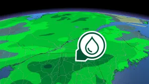
* WHAT...Urban and small stream flooding caused by excessiverainfall is expected.* WHERE...A portion of southeast Texas, including the followingcounties, Brazoria, Chambers, Fort Bend, Harris, Liberty andWaller.* WHEN...Until 515 PM CDT.* IMPACTS...Minor flooding in low-lying and poor drainage areas.Ponding of water in urban or other areas is occurring or isimminent.* ADDITIONAL DETAILS...- At 206 PM CDT, Doppler radar indicated heavy rain due tothunderstorms. This will cause urban and small streamflooding. Up to 2 inches of rain have fallen.- Additional rainfall amounts of 1 to 3 inches are expectedover the area. This additional rain will result in minorflooding.- Some locations that will experience flooding include...Pasadena, Pearland, Sugar Land, Baytown, Missouri City, DeerPark, Rosenberg, Stafford, South Houston, Bellaire, Humble,West University Place, Katy, Richmond, Galena Park, JacintoCity, Jersey Village, northwestern Manvel, Hunters CreekVillage and Bunker Hill Village.- http://www.weather.gov/safety/flood
AQAHGXThe Texas Commission on Environmental Quality (TCEQ) has issued anOzone Action Day for the Houston, Galveston, and Brazoria area forTuesday, May 14, 2024.Atmospheric conditions are expected to be favorable for producinghigh levels of ozone pollution in the Houston, Galveston, andsurrounding areas on Tuesday. You can help prevent ozone pollution bysharing a ride, walking, riding a bicycle, taking your lunch to work,avoiding drive through lanes, conserving energy and keeping your vehicleproperly tuned.For more information on ozone:Ozone: The Facts www.tceq.texas.gov/airquality/monops/ozonefacts.htmlEPA AirNow: www.airnow.gov/?city=Houston&state=TX&country=USATake Care of Texas:www.takecareoftexas.org/conservation-tips/keep-our-air-clean