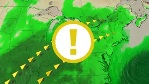
Alertes en vigueurChita, TX
Do not drive cars through flooded areas.Caution is urged when walking near riverbanks.Turn around, don't drown when encountering flooded roads. Most flooddeaths occur in vehicles.Motorists should not attempt to drive around barricades or drivecars through flooded areas.For more hydrologic information, copy and paste the following websiteaddress into your favorite web browser URL bar:water.weather.gov/ahps2/index.php?wfo=shvThe next statement will be issued Wednesday morning at 945 AM CDT.
...The Flood Warning continues for the following rivers in Texas...Neches River At Rockland affecting Angelina, Tyler, Jasper andPolk Counties.Neches River Near Diboll affecting Tyler, Trinity, Houston, Polkand Angelina Counties.Neches River Near Alto affecting Houston, Anderson, Cherokee andTrinity Counties.Neches River Near Neches affecting Houston, Anderson and CherokeeCounties.For the Neches River...including Neches, Alto, Diboll, Rockland...Moderate flooding is forecast.* WHAT...Moderate flooding is occurring and moderate flooding isforecast.* WHERE...Neches River near Alto.* WHEN...Until further notice.* IMPACTS...At 20.0 feet, Lowland flooding of the heavily woodedfloodplain will continue for the next several days. As the riverfalls slowly, flooding will gradually decrease.* ADDITIONAL DETAILS...- At 9:15 AM CDT Tuesday the stage was 19.7 feet.- Bankfull stage is 16.0 feet.- Recent Activity...The maximum river stage in the 24 hoursending at 9:15 AM CDT Tuesday was 20.4 feet.- Forecast...The river is expected to fall to 16.0 feet Sundaymorning.- Flood stage is 16.0 feet.- Flood History...This crest compares to a previous crest of19.7 feet on 02/19/1950.- http://www.weather.gov/safety/flood