Alertes en vigueurSuccess, MS
You should monitor later forecasts and be alert for possible FloodWarnings. Those living in areas prone to flooding should be preparedto take action should flooding develop.
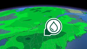
* WHAT...Flooding caused by excessive rainfall continues to bepossible.* WHERE...Portions of southeast Louisiana, including the followingparishes, Central Tangipahoa, East Baton Rouge, East Feliciana,Eastern Ascension, Iberville, Lower Tangipahoa, NorthernLivingston, Northern St. Tammany, Northern Tangipahoa, PointeCoupee, Southeast St. Tammany, Southern Livingston, SouthwesternSt. Tammany, St. Helena, Washington, West Baton Rouge, WestFeliciana and Western Ascension and southern Mississippi,including the following areas, Amite, Northern Hancock, NorthernHarrison, Northern Jackson, Pearl River, Pike, Southern Hancock,Southern Harrison, Southern Jackson, Walthall and Wilkinson.* WHEN...Through Tuesday morning.* IMPACTS...Excessive runoff may result in flooding of rivers,creeks, streams, and other low-lying and flood-prone locations.Flooding may occur in poor drainage and urban areas.* ADDITIONAL DETAILS...- Multiple rounds of storms will be moving through the areathroughout the next 2 days. 3 to 5 inches of rainfall withlocally higher amounts in excess of 6 inches will be possibletonight through Tuesday morning, enhancing the flash floodingthreat.- http://www.weather.gov/safety/flood
If outdoors, consider seeking shelter inside a building.These storms may intensify, so be certain to monitor local radiostations and available television stations for additional informationand possible warnings from the National Weather Service.A Severe Thunderstorm Watch remains in effect until 1100 AM CDT forsouthern Mississippi.
At 933 AM CDT, Doppler radar was tracking strong thunderstorms alonga line extending from near Mcneil to Picayune to near Lacombe.Movement was east at 55 mph.HAZARD...Winds in excess of 40 mph and pea size hail.SOURCE...Radar indicated.IMPACT...Gusty winds could knock down tree limbs and blow aroundunsecured objects. Minor damage to outdoor objects ispossible.Locations impacted include...Gulfport, Biloxi, Slidell, Long Beach, Picayune, Bay St. Louis,Waveland, Diamondhead, Pearl River, Kiln, Lyman, Crossroads,Shoreline Park, Stennis Space Center, Saucier, Mcneil, Lacombe,Gulfport Airport, and Slidell Airport.This includes the following Interstates...Interstate 10 in Louisiana between mile markers 268 and 273.Interstate 10 in Mississippi between mile markers 1 and 42.Interstate 12 between mile markers 68 and 84.Interstate 59 in Louisiana between mile markers 1 and 11.Interstate 59 in Mississippi between mile markers 1 and 26.