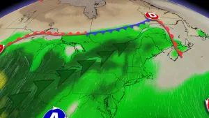
Alertes en vigueurNapoleon, MS
Caution is urged when walking near riverbanks.Motorists should not attempt to drive around barricades or drivecars through flooded areas.Additional information is available at www.weather.gov/lix. Clickon the Rivers and Lakes menu for forecasts and observations.The next statement will be issued Friday morning at 1030 AM CDT.
...The Flood Warning continues for the following rivers inMississippi...Louisiana...Pearl River Near Pearl River affecting Hancock, Pearl River andSt. Tammany Counties.Pearl River Near Bogalusa affecting Pearl River and WashingtonCounties.For the Lower Pearl River...including Bogalusa, Pearl River...Minorflooding is forecast.* WHAT...Minor flooding is occurring and minor flooding is forecast.* WHERE...Pearl River near Pearl River.* WHEN...Until further notice.* IMPACTS...At 15.5 feet, Secondary roads to the river andthroughout Honey Island Swamp are inundated. Property in thevicinity of the gage is flooded threatening about 20 homes alongthe left bank. The Bogue Chitto National Wildlife Refuge will beclosed to hunting at the 15.5 foot stage.* ADDITIONAL DETAILS...- At 8:00 PM CDT Thursday the stage was 14.8 feet.- Bankfull stage is 12.0 feet.- Forecast...The river is expected to rise to a crest of 15.5feet Sunday morning.- Flood stage is 14.0 feet.- http://www.weather.gov/safety/flood