Alertes en vigueurUniversity Place, LA
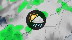
...The Flood Warning is extended for the following rivers inLouisiana...Bayou Des Cannes Near EuniceBayou Anacoco Near Rosepine...The Flood Warning continues for the following rivers in Texas...Louisiana...Sabine River Near BurkevillePine Island Bayou Near Sour LakeBundick Creek At Bundick LakeCalcasieu River Near KinderCalcasieu River Near OberlinCalcasieu River Near Salt Water BarrierCalcasieu River near White Oak ParkCalcasieu River Near GlenmoraCalcasieu River Near OakdaleMermentau River Near MermentauSabine River Near Bon WierSabine River Near DeweyvilleNeches River Near EvadaleNeches River Near Town BluffNeches River at Neches River Saltwater BarrierVillage Creek Near KountzeAdditional information is available at www.weather.gov.The next statement will be issued Wednesday afternoon at 100 PM CDT.* WHAT...Minor flooding is occurring and minor flooding is forecast.* WHERE...Calcasieu River near White Oak Park.* WHEN...Until further notice.* IMPACTS...At 3.0 feet, Water over lowest portions of Goos FerryRoad. Cars should be moved to higher ground.* ADDITIONAL DETAILS...- At 9:35 PM CDT Tuesday the stage was 2.4 feet.- Recent Activity...The maximum river stage in the 24 hoursending at 9:35 PM CDT Tuesday was 2.4 feet.- Forecast...The river is expected to rise to a crest of 3.5feet early Thursday afternoon.- Flood stage is 2.0 feet.- http://www.weather.gov/safety/flood
...The Flood Warning is extended for the following rivers inLouisiana...Bayou Des Cannes Near EuniceBayou Anacoco Near Rosepine...The Flood Warning continues for the following rivers in Texas...Louisiana...Sabine River Near BurkevillePine Island Bayou Near Sour LakeBundick Creek At Bundick LakeCalcasieu River Near KinderCalcasieu River Near OberlinCalcasieu River Near Salt Water BarrierCalcasieu River near White Oak ParkCalcasieu River Near GlenmoraCalcasieu River Near OakdaleMermentau River Near MermentauSabine River Near Bon WierSabine River Near DeweyvilleNeches River Near EvadaleNeches River Near Town BluffNeches River at Neches River Saltwater BarrierVillage Creek Near KountzeAdditional information is available at www.weather.gov.The next statement will be issued Wednesday afternoon at 100 PM CDT.* WHAT...Moderate flooding is occurring and moderate flooding isforecast.* WHERE...Sabine River near Deweyville.* WHEN...Until further notice.* IMPACTS...At 27.0 feet, Widespread moderate lowland flooding willoccur. Homes in Deweyville closest to the river are flooded.Flooding of homes in the Indian Lakes and River Oaks sections willalso occur. Low-lying roads and a few homes in SouthwestBeauregard Parish have some flooding.* ADDITIONAL DETAILS...- At 8:45 PM CDT Tuesday the stage was 26.2 feet.- Recent Activity...The maximum river stage in the 24 hoursending at 8:45 PM CDT Tuesday was 26.2 feet.- Forecast...The river is expected to rise to a crest of 27.1feet Thursday evening.- Flood stage is 24.0 feet.- http://www.weather.gov/safety/flood