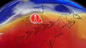
Alertes en vigueurTurps, LA
...The Flood Warning is extended for the following rivers inLouisiana...Texas...Bundick Creek At Bundick LakeMermentau River Near MermentauBayou Anacoco Near RosepinePine Island Bayou Near Sour Lake...The Flood Warning continues for the following rivers inLouisiana...Texas...Calcasieu River Near OakdaleCalcasieu River Near KinderCalcasieu River Near OberlinCalcasieu River Near Salt Water BarrierCalcasieu River near White Oak ParkCalcasieu River Near GlenmoraSabine River Near Bon WierSabine River Near DeweyvilleNeches River Near Town BluffNeches River at Neches River Saltwater BarrierAdditional information is available at www.weather.gov.The next statement will be issued Friday morning at 1000 AM CDT.* WHAT...Minor flooding is occurring and minor flooding is forecast.* WHERE...Bundick Creek at Bundick Lake.* WHEN...Until further notice.* IMPACTS...At 97.0 feet, Minor flooding begins around the lake,especially the north end of the lake.* ADDITIONAL DETAILS...- At 8:00 AM CDT Thursday the stage was 97.3 feet.- Recent Activity...The maximum river stage in the 24 hoursending at 8:00 AM CDT Thursday was 97.6 feet.- Forecast...The river will fall to flood stage tomorrowmorning. It will then rise to 97.5 feet early Saturdaymorning. It will fall to 97.3 feet early Saturday afternoon.It will then rise to 97.5 feet Sunday evening. It will fallagain but remain above flood stage.- Flood stage is 97.0 feet.- http://www.weather.gov/safety/flood
...The Flood Warning is extended for the following rivers inLouisiana...Texas...Bundick Creek At Bundick LakeMermentau River Near MermentauBayou Anacoco Near RosepinePine Island Bayou Near Sour Lake...The Flood Warning continues for the following rivers inLouisiana...Texas...Calcasieu River Near OakdaleCalcasieu River Near KinderCalcasieu River Near OberlinCalcasieu River Near Salt Water BarrierCalcasieu River near White Oak ParkCalcasieu River Near GlenmoraSabine River Near Bon WierSabine River Near DeweyvilleNeches River Near Town BluffNeches River at Neches River Saltwater BarrierAdditional information is available at www.weather.gov.The next statement will be issued Friday morning at 1000 AM CDT.* WHAT...Moderate flooding is occurring and moderate flooding isforecast.* WHERE...Sabine River near Deweyville.* WHEN...Until further notice.* IMPACTS...At 27.9 feet, This flooding will be similar to theflooding expierenced in the flood of March 2001. Homes inDeweyville have water in them.* ADDITIONAL DETAILS...- At 8:45 AM CDT Thursday the stage was 26.8 feet.- Recent Activity...The maximum river stage in the 24 hoursending at 8:45 AM CDT Thursday was 26.8 feet.- Forecast...The river is expected to rise to 27.6 feet earlySunday afternoon. Additional rises are possible thereafter.- Flood stage is 24.0 feet.- http://www.weather.gov/safety/flood
...The Flood Warning is extended for the following rivers inLouisiana...Texas...Bundick Creek At Bundick LakeMermentau River Near MermentauBayou Anacoco Near RosepinePine Island Bayou Near Sour Lake...The Flood Warning continues for the following rivers inLouisiana...Texas...Calcasieu River Near OakdaleCalcasieu River Near KinderCalcasieu River Near OberlinCalcasieu River Near Salt Water BarrierCalcasieu River near White Oak ParkCalcasieu River Near GlenmoraSabine River Near Bon WierSabine River Near DeweyvilleNeches River Near Town BluffNeches River at Neches River Saltwater BarrierAdditional information is available at www.weather.gov.The next statement will be issued Friday morning at 1000 AM CDT.* WHAT...Moderate flooding is occurring and moderate flooding isforecast.* WHERE...Sabine River near Bon Wier.* WHEN...Until further notice.* IMPACTS...At 36.0 feet, Major lowland flooding will occur. SabineSands Road has about one to three feet of water covering the road.* ADDITIONAL DETAILS...- At 9:15 AM CDT Thursday the stage was 34.3 feet.- Recent Activity...The maximum river stage in the 24 hoursending at 9:15 AM CDT Thursday was 34.3 feet.- Forecast...The river is expected to rise to a crest of 35.9feet Sunday morning.- Flood stage is 30.0 feet.- http://www.weather.gov/safety/flood