Alertes en vigueurNewllano, LA
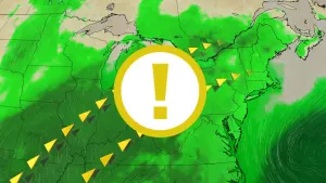
...The Flood Warning is extended for the following rivers inLouisiana...Bundick Creek At Bundick LakeBayou Des Cannes Near EuniceCalcasieu River Near OakdaleMermentau River Near Mermentau...The Flood Warning continues for the following rivers inLouisiana...Texas...Bayou Anacoco Near RosepineCalcasieu River Near OberlinCalcasieu River Near Salt Water BarrierCalcasieu River near White Oak ParkCalcasieu River Near GlenmoraCalcasieu River Near KinderSabine River Near BurkevilleSabine River Near Bon WierSabine River Near DeweyvilleNeches River Near EvadaleNeches River Near Town BluffPine Island Bayou Near Sour LakeAdditional information is available at www.weather.gov.The next statement will be issued as needed. Wednesday morning at700 AM CDT.* WHAT...Moderate flooding is occurring and moderate flooding isforecast.* WHERE...Sabine River near Bon Wier.* WHEN...Until further notice.* IMPACTS...At 35.0 feet, Expect several secondary roads in theMerryville and Bon Wier areas near the river to be closed.* ADDITIONAL DETAILS...- At 10:15 AM CDT Tuesday the stage was 33.9 feet.- Recent Activity...The maximum river stage in the 24 hoursending at 10:15 AM CDT Tuesday was 33.9 feet.- Forecast...The river is expected to rise to a crest of 34.8feet early Thursday morning.- Flood stage is 30.0 feet.- http://www.weather.gov/safety/flood
...The Flood Warning is extended for the following rivers inLouisiana...Bundick Creek At Bundick LakeBayou Des Cannes Near EuniceCalcasieu River Near OakdaleMermentau River Near Mermentau...The Flood Warning continues for the following rivers inLouisiana...Texas...Bayou Anacoco Near RosepineCalcasieu River Near OberlinCalcasieu River Near Salt Water BarrierCalcasieu River near White Oak ParkCalcasieu River Near GlenmoraCalcasieu River Near KinderSabine River Near BurkevilleSabine River Near Bon WierSabine River Near DeweyvilleNeches River Near EvadaleNeches River Near Town BluffPine Island Bayou Near Sour LakeAdditional information is available at www.weather.gov.The next statement will be issued as needed. Wednesday morning at700 AM CDT.* WHAT...Minor flooding is forecast.* WHERE...Sabine River near Burkeville.* WHEN...Until further notice.* IMPACTS...At 36.0 feet, Residential flooding in the River BendSubdivision occurs.* ADDITIONAL DETAILS...- At 10:15 AM CDT Tuesday the stage was 35.9 feet.- Forecast...The river is expected to rise above flood stagelate this morning and continue rising to a crest of 36.7 feetjust after midnight tonight.- Flood stage is 36.0 feet.- http://www.weather.gov/safety/flood