Alertes en vigueurHargrove, LA
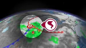
...The Flood Warning continues for the following rivers inLouisiana...Texas...Calcasieu River Near Salt Water BarrierCalcasieu River Near GlenmoraSabine River Near DeweyvilleNeches River Near EvadaleNeches River Near Town BluffNeches River at Neches River Saltwater Barrier...The Flood Warning is extended for the following rivers inLouisiana...Texas...Calcasieu River near White Oak ParkMermentau River Near MermentauPine Island Bayou Near Sour LakeAdditional information is available at www.weather.gov.The next statement will be issued Saturday morning at 900 AM CDT.* WHAT...Minor flooding is occurring and minor flooding is forecast.* WHERE...Sabine River near Deweyville.* WHEN...Until further notice.* IMPACTS...At 26.0 feet, Moderate lowland flooding will occur. Thelowest homes between Deweyville and the river begin to flood,especially in the Indian Lakes and River Oaks sections. Low-lyingroads and a few homes in Southwestern Beauregard Parish have someflooding.* ADDITIONAL DETAILS...- At 7:45 AM CDT Friday the stage was 25.9 feet.- Recent Activity...The maximum river stage in the 24 hoursending at 7:45 AM CDT Friday was 26.1 feet.- Forecast...The river is expected to fall to 25.1 feetWednesday morning.- Flood stage is 24.0 feet.- http://www.weather.gov/safety/flood
...The Flood Warning continues for the following rivers inLouisiana...Texas...Calcasieu River Near Salt Water BarrierCalcasieu River Near GlenmoraSabine River Near DeweyvilleNeches River Near EvadaleNeches River Near Town BluffNeches River at Neches River Saltwater Barrier...The Flood Warning is extended for the following rivers inLouisiana...Texas...Calcasieu River near White Oak ParkMermentau River Near MermentauPine Island Bayou Near Sour LakeAdditional information is available at www.weather.gov.The next statement will be issued Saturday morning at 900 AM CDT.* WHAT...Minor flooding is forecast.* WHERE...Calcasieu River near Salt Water Barrier.* WHEN...Until early Monday morning.* IMPACTS...At 4.0 feet, Minor marshland flooding occurs. Floodingalso begins on River Road in north Lake Charles.* ADDITIONAL DETAILS...- At 6:00 AM CDT Friday the stage was 3.9 feet.- Forecast...The river will oscillate around flood stage with amaximum value of 4.0 feet this afternoon.- Flood stage is 4.0 feet.- http://www.weather.gov/safety/flood