Alertes en vigueurFifth Ward, LA
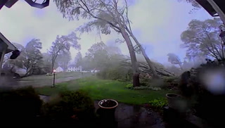
If outdoors, consider seeking shelter inside a building.Torrential rainfall is also occurring with this storm and may lead tolocalized flooding. Do not drive your vehicle through floodedroadways.This storm may intensify, so be certain to monitor local radiostations and available television stations for additional informationand possible warnings from the National Weather Service.A Severe Thunderstorm Watch remains in effect until 300 AM CDT forcentral Louisiana.
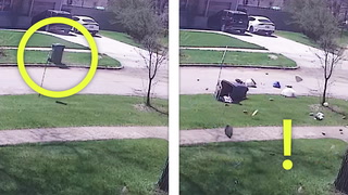
At 1237 AM CDT, Doppler radar was tracking a strong thunderstorm overGlenmora, moving east at 35 mph.HAZARD...Wind gusts up to 50 mph and pea size hail.SOURCE...Radar indicated.IMPACT...Gusty winds could knock down tree limbs and blow aroundunsecured objects. Minor damage to vegetation and outdoorobjects is possible.Locations impacted include...Marksville, Bunkie, Glenmora, Cheneyville, Turkey Creek, Cottonport,Mansura, Lecompte, Hessmer, Evergreen, Echo, Poland, Woodworth,Forest Hill, and Mcnary.This includes Interstate 49 between mile markers 47 and 72.