Alertes en vigueurStrand, IA

Veille d’orage violent
Émis à mar. 10:59 mai. 21
Publié par : National Weather Service
Description
SEVERE THUNDERSTORM WATCH 275 REMAINS VALID UNTIL 1 PM CDT THISAFTERNOON FOR THE FOLLOWING AREASIN IOWA THIS WATCH INCLUDES 19 COUNTIESIN CENTRAL IOWAPOWESHIEK TAMAIN NORTHEAST IOWABLACK HAWKIN SOUTH CENTRAL IOWAAPPANOOSE CLARKE DECATURLUCAS MADISON MAHASKAMARION MONROE RINGGOLDUNION WARREN WAYNEIN SOUTHEAST IOWADAVIS WAPELLOIN SOUTHWEST IOWAADAMS TAYLORTHIS INCLUDES THE CITIES OF ALBIA, ALLERTON, BEDFORD, BLOOMFIELD,CARLISLE, CEDAR FALLS, CENTERVILLE, CHARITON, CORNING, CORYDON,CRESTON, DYSART, EARLHAM, GLADBROOK, GRINNELL, HUMESTON,INDIANOLA, KNOXVILLE, LAMONI, LENOX, LEON, MOUNT AYR, NEW MARKET,NORWALK, OSCEOLA, OSKALOOSA, OTTUMWA, PELLA, SEYMOUR, TAMA,TOLEDO, TRAER, WATERLOO, AND WINTERSET.* PRIMARY THREATS INCLUDE...SCATTERED DAMAGING WINDS AND ISOLATED SIGNIFICANT GUSTS TO 75MPH POSSIBLE.ISOLATED LARGE HAIL EVENTS TO 1.5 INCHES IN DIAMETER POSSIBLE.A TORNADO OR TWO POSSIBLE.
Détails complets  
Alerte des crues éclair
Émis à mar. 11:32 mai. 21
Publié par : National Weather Service
Action Recommandée

You should monitor later forecasts and be prepared to take actionshould Flash Flood Warnings be issued.For the latest river and stream observations and forecasts refer toweather.gov/desmoines/water.

Description

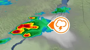
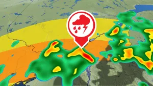
* WHAT...Flash flooding caused by excessive rainfall continues to bepossible.* WHERE...Portions of south central and southwest Iowa, includingthe following counties, in south central Iowa, Clarke and Union.In southwest Iowa, Adams and Taylor.* WHEN...Until 7 PM CDT this evening.* IMPACTS...Excessive runoff may result in flooding of rivers,creeks, streams, and other low-lying and flood-prone locations.Flooding may occur in poor drainage and urban areas.* ADDITIONAL DETAILS...- Rainfall of 3 to 5 inches with isolated higher amounts fellover parts of central Iowa last night into this morning andled to flash flooding in some areas. Additional round ofstorms is expected this afternoon that may cause new flashflooding or prolong or renew flash flooding in areas thatexperienced flash flooding earlier.