Alertes en vigueurBlackrock, ID
If you are in the advisory area, remain alert to possible floodingor the possibility of the advisory being upgraded to a warning.Caution is urged when walking near riverbanks.Additional information is available at www.weather.gov/pocatello.
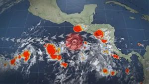
...The Flood Advisory continues for the following rivers in Idaho...Portneuf River at Topaz affecting Bannock County..Warm temperatures will continue to melt high mountain snowpack andkeep river flows elevated.* WHAT...Flooding caused by snowmelt continues.* WHERE...Portneuf River at Topaz.* WHEN...Until further notice.* IMPACTS...At 4.0 feet, Lowland and crop field flooding possiblefrom Pebble Creek to Inkom.* ADDITIONAL DETAILS...- At 10:15 AM MDT Thursday the stage was 4.0 feet.- Forecast...The river is expected to rise to a crest of 4.0feet this afternoon.- Action stage is 3.5 feet.- Flood stage is 4.0 feet.- http://www.weather.gov/safety/flood
Winds this strong can make driving difficult, especially for highprofile vehicles and any reduced visibilities from blowing dust. Useextra caution. Secure outdoor objects.
* WHAT...West winds 25 to 35 mph with gusts up to around 50 mphexpected.* WHERE...Challis/Pahsimeroi Valleys, Lost River Valley, Beaverhead- Lemhi Highlands, Teton Valley, Eastern Magic Valley,Shoshone/Lava Beds, Marsh and Arbon Highlands, Raft River Regionespecially the Idahome area, and Southern Hills/Albion Mountains.* WHEN...From noon to 8 PM MDT Friday.* IMPACTS...Gusty winds could make driving difficult, especially forhigh profile vehicles. Unsecured objects may be blown around.Blowing dust is possible, which could reduce visibilities.