Alertes en vigueurSeminole Hills, FL
You should monitor later forecasts and be alert for possible FloodWarnings. Those living in areas prone to flooding should be preparedto take action should flooding develop.
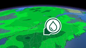
* WHAT...Flooding caused by excessive rainfall is possible.* WHERE...Portions of southeast Alabama, including the followingareas, Coffee, Dale, Geneva, Henry and Houston, Florida, includingthe following areas, Calhoun, Central Walton, Coastal Bay, CoastalFranklin, Coastal Gulf, Coastal Jefferson, Coastal Wakulla,Gadsden, Holmes, Inland Bay, Inland Franklin, Inland Gulf, InlandJefferson, Inland Wakulla, Jackson, Leon, Liberty, North Walton,South Walton and Washington, and Georgia, including the followingareas, Baker, Calhoun, Clay, Colquitt, Decatur, Dougherty, Early,Grady, Lee, Miller, Mitchell, Quitman, Randolph, Seminole,Terrell, Thomas and Worth.* WHEN...From Monday morning through Tuesday evening.* IMPACTS...Excessive runoff may result in flooding of rivers,creeks, streams, and other low-lying and flood-prone locations.Flooding may occur in poor drainage and urban areas. Storm drainsand ditches may become clogged with debris.* ADDITIONAL DETAILS...- Multiple rounds of showers and thunderstorms are expectedwithin the watch area. Storm total rainfall amounts of 2 to 5inches are expected with localized higher amounts.- http://www.weather.gov/safety/flood
Swim near a lifeguard. If caught in a rip current, relax andfloat. Don't swim against the current. If able, swim in adirection following the shoreline. If unable to escape, face theshore and call or wave for help.
* WHAT...Dangerous rip currents expected.* WHERE...Walton, Bay, Gulf, and Franklin County Beaches.* WHEN...From 8 AM EDT /7 AM CDT/ this morning through Tuesdayevening.* IMPACTS...Rip currents can sweep even the best swimmers awayfrom shore into deeper water.* ADDITIONAL DETAILS...Surf conditions will begin to deteoriatelate this morning, with multiple rounds of thunderstorms throughTuesday.