Alertes en vigueurTexas A&M Golf Course, TX
The National Weather Service has issued Tornado Watch 249 ineffect until 10 PM CDT this evening for the following areasIn Texas this watch includes 21 countiesIn southeast TexasAustin Brazoria BrazosBurleson Chambers ColoradoFort Bend Galveston GrimesHarris Houston LibertyMadison Montgomery PolkSan Jacinto Trinity WalkerWaller Washington WhartonThis includes the cities of Alvin, Anahuac, Angleton, Bellville,Brenham, Brookshire, Bryan, Caldwell, Cleveland, Clute,Coldspring, College Station, Columbus, Conroe, Corrigan,Crockett, Dayton, Dickinson, Eagle Lake, El Campo, First Colony,Freeport, Friendswood, Galveston, Groveton, Hempstead, Houston,Huntsville, Lake Jackson, League City, Liberty, Livingston,Madisonville, Mission Bend, Missouri City, Mont Belvieu,Navasota, Old River-Winfree, Pearland, Pecan Grove, Prairie View,Rosenberg, Sealy, Shepherd, Somerville, Stowell, Sugar Land,Texas City, The Woodlands, Trinity, Waller, Weimar, Wharton,and Winnie.
Please report observed flooding to local emergency services or lawenforcement and request they pass this information to the NationalWeather Service when you can do so safely.Turn around, don't drown when encountering flooded roads. Most flooddeaths occur in vehicles.Motorists should not attempt to drive around barricades or drivecars through flooded areas.Additional information is available at www.weather.gov/hgx.The next statement will be issued late tonight at 430 AM CDT.
...Forecast flooding changed from Minor to Moderate severity for thefollowing rivers in Texas...Navasota River near Normangee affecting Grimes, Madison andBrazos Counties.For the Navasota River...including Normangee...Moderate flooding isforecast.* WHAT...Minor flooding is occurring and moderate flooding isforecast.* WHERE...Navasota River near Normangee.* WHEN...Until further notice.* IMPACTS...At 17.0 feet, Minor lowland flooding continues withwidespread inundation of the flood plain in the vicinity of thegage with the river more than 1 mile wide. Long Trussel Road innortheast Brazos County below State Highway 21 is threatened.At 18.0 feet, Moderate lowland flooding begins as three channelsmerge into one below State Highway 21. There is widespreadinundation of the flood plain in the vicinity of the gage with theriver more than 1.5 miles wide. Long Trussel Road in northeastBrazos County below State Highway 21 becomes inundated.* ADDITIONAL DETAILS...- At 10:00 AM CDT Thursday the stage was 16.6 feet.- Bankfull stage is 12.0 feet.- Recent Activity...The maximum river stage in the 24 hoursending at 10:00 AM CDT Thursday was 19.2 feet.- Forecast...The river is expected to rise to a crest of 18.1feet late Sunday morning.- Flood stage is 15.0 feet.- Flood History...This crest compares to a previous crest of18.2 feet on 03/15/2007.- http://www.weather.gov/safety/flood
You should monitor later forecasts and be alert for possible FloodWarnings. Those living in areas prone to flooding should be preparedto take action should flooding develop.
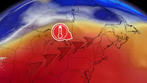
* WHAT...Flooding caused by excessive rainfall continues to bepossible.* WHERE...A portion of southeast Texas, including the followingareas, Austin, Brazos, Burleson, Coastal Harris, Grimes, Houston,Inland Harris, Madison, Montgomery, Northern Liberty, Polk, SanJacinto, Southern Liberty, Trinity, Walker, Waller and Washington.* WHEN...Through Friday morning.* IMPACTS...Excessive runoff may result in flooding of rivers,creeks, streams, and other low-lying and flood-prone locations.* ADDITIONAL DETAILS...- Widespread thunderstorms will develop across the area thisafternoon and evening, with the presence of a warm frontalboundary and abundant moisture providing favorable conditionsfor heavy rainfall. The flood threat will be furtherexacerbated by well-saturated soils still present acrossportions of the region due to significant antecedentrainfall. In general, 3-6" of new rainfall can be expectedfor areas north of the I-10 corridor through this evening.Isolated locally higher totals are possible as well. This mayresult in street flooding, as well as rises along area riversand creeks.- http://www.weather.gov/safety/flood
Turn around, don't drown when encountering flooded roads. Most flooddeaths occur in vehicles.
* WHAT...Flooding caused by excessive rainfall is expected.* WHERE...A portion of southeast Texas, including the followingcounties, Brazos, Burleson, Grimes, Montgomery and Walker.* WHEN...Until 600 PM CDT.* IMPACTS...Minor flooding in low-lying and poor drainage areas.* ADDITIONAL DETAILS...- At 400 PM CDT, Doppler radar indicated heavy rain due tothunderstorms. Minor flooding is ongoing or expected to beginshortly in the advisory area. Between 1 and 2 inches of rainhave fallen.- Additional rainfall amounts of 1 to 3 inches are expectedover the area. This additional rain will result in minorflooding.- Some locations that will experience flooding include...Southeastern College Station, Huntsville, Snook, Millican,Anderson, Huntsville State Park, Roans Prairie, Richards,Carlos, Crabbs Prairie and Wellborn.- http://www.weather.gov/safety/flood