Alertes en vigueurWeldon, TX
Do not drive cars through flooded areas.Caution is urged when walking near riverbanks.Turn around, don't drown when encountering flooded roads. Most flooddeaths occur in vehicles.For more hydrologic information, copy and paste the following websiteaddress into your favorite web browser URL bar:water.weather.gov/ahps2/index.php?wfo=shvThe next statement will be issued Thursday morning at 815 AM CDT.
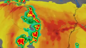
...The National Weather Service in Shreveport LA has issued a FloodWarning for the following rivers in Texas...Neches River Near Neches affecting Cherokee, Anderson and HoustonCounties.For the Neches River...including Neches, Alto, Diboll...Minorflooding is forecast.* WHAT...Minor flooding is forecast.* WHERE...Neches River near Neches.* WHEN...From Friday evening until further notice.* IMPACTS...At 14.0 feet, Minor lowland flooding. Move livestockand equipment to higher ground away from the river.* ADDITIONAL DETAILS...- At 7:30 AM CDT Wednesday the stage was 11.8 feet.- Bankfull stage is 12.0 feet.- Forecast...The river is expected to rise above flood stageFriday evening and continue rising to 13.7 feet Mondaymorning.- Flood stage is 12.0 feet.- Flood History...This crest compares to a previous crest of13.7 feet on 03/31/2018.- http://www.weather.gov/safety/flood
Do not drive cars through flooded areas.Caution is urged when walking near riverbanks.Turn around, don't drown when encountering flooded roads. Most flooddeaths occur in vehicles.Motorists should not attempt to drive around barricades or drivecars through flooded areas.For more hydrologic information, copy and paste the following websiteaddress into your favorite web browser URL bar:water.weather.gov/ahps2/index.php?wfo=shvThe next statement will be issued Thursday morning at 815 AM CDT.
...The Flood Warning is extended for the following rivers in Texas...Neches River Near Alto affecting Cherokee, Trinity, Anderson andHouston Counties....The Flood Warning continues for the following rivers in Texas...Neches River Near Diboll affecting Houston, Tyler, Angelina,Trinity and Polk Counties.For the Neches River...including Neches, Alto, Diboll...Minorflooding is forecast.* WHAT...Minor flooding is occurring and minor flooding is forecast.* WHERE...Neches River near Diboll.* WHEN...Until further notice.* IMPACTS...At 14.0 feet, Minor lowland flooding of boat ramps,paths, and trails. Move livestock and equipment to higher ground.* ADDITIONAL DETAILS...- At 7:15 AM CDT Wednesday the stage was 13.9 feet.- Bankfull stage is 12.0 feet.- Recent Activity...The maximum river stage in the 24 hoursending at 7:15 AM CDT Wednesday was 14.2 feet.- Forecast...The river is expected to fall to 12.5 feet Mondaymorning.- Flood stage is 12.0 feet.- Flood History...This crest compares to a previous crest of13.9 feet on 04/28/1977.- http://www.weather.gov/safety/flood
Do not drive cars through flooded areas.Caution is urged when walking near riverbanks.Turn around, don't drown when encountering flooded roads. Most flooddeaths occur in vehicles.Motorists should not attempt to drive around barricades or drivecars through flooded areas.For more hydrologic information, copy and paste the following websiteaddress into your favorite web browser URL bar:water.weather.gov/ahps2/index.php?wfo=shvThe next statement will be issued Thursday morning at 815 AM CDT.
...The Flood Warning is extended for the following rivers in Texas...Neches River Near Alto affecting Cherokee, Trinity, Anderson andHouston Counties....The Flood Warning continues for the following rivers in Texas...Neches River Near Diboll affecting Houston, Tyler, Angelina,Trinity and Polk Counties.For the Neches River...including Neches, Alto, Diboll...Minorflooding is forecast.* WHAT...Minor flooding is occurring and minor flooding is forecast.* WHERE...Neches River near Alto.* WHEN...Until Sunday evening.* IMPACTS...At 16.0 feet, Boat ramps and picnic areas near the riverwill begin to flood. Ranchers should move cattle and equipmentnear the river to higher ground.* ADDITIONAL DETAILS...- At 7:15 AM CDT Wednesday the stage was 16.5 feet.- Bankfull stage is 16.0 feet.- Recent Activity...The maximum river stage in the 24 hoursending at 7:15 AM CDT Wednesday was 16.9 feet.- Forecast...The river will fall below flood stage just aftermidnight tonight to 15.9 feet early tomorrow afternoon. Itwill then rise to flood stage Saturday morning. It will fallfor the remainder of the period.- Flood stage is 16.0 feet.- Flood History...This crest compares to a previous crest of16.5 feet on 03/12/2012.- http://www.weather.gov/safety/flood