Alertes en vigueurNopal, TX
A Red Flag Warning means that critical fire weather conditionsare either occurring now or will shortly. A combination of strongwinds, low relative humidity and warm temperatures will increasepotential for fire growth.A Fire Weather Watch means that critical fire weather conditionsare forecast to occur. Listen for later forecasts and possibleRed Flag Warnings.
...RED FLAG WARNING REMAINS IN EFFECT THROUGH THIS EVENING FORRELATIVE HUMIDITY VALUES AS LOW AS 4 PERCENT, 20 FT WINDS GREATERTHAN 20 MPH, AND EXTREME FIRE DANGER......FIRE WEATHER WATCH IN EFFECT FROM LATE SUNDAY MORNING THROUGHSUNDAY EVENING FOR FAR WEST TEXAS AND THE MOUNTAINS FOR RELATIVEHUMIDITY VALUES AS LOW AS 4 PERCENT, 20 FT WINDS GREATER THAN 15MPH AND CRITICAL TO EXTREME FIRE DANGER......FIRE WEATHER WATCH IN EFFECT FROM LATE SUNDAY MORNING THROUGHSUNDAY EVENING FOR FAR WEST TEXAS AND THE MOUNTAINS FOR RELATIVEHUMIDITY VALUES AS LOW AS 4 PERCENT, 20 FT WINDS GREATER THAN 15MPH AND CRITICAL TO EXTREME FIRE DANGER...* AFFECTED AREA...Guadalupe Mountains Above 7000 Feet, Guadalupeand Delaware Mountains, Van Horn and Highway 54 Corridor,Eastern Culberson County, Chinati Mountains, Marfa Plateau,Davis Mountains and Davis Mountains Foothills.* TIMING...For the Red Flag Warning, until 10 PM CDT /9 PM MDT/this evening. For the Fire Weather Watch, from Sundayafternoon through Sunday evening.* WINDS...West 25 to 35 mph with gusts up to 55 mph in themountains.* RELATIVE HUMIDITY...As low as 4 percent.* RFTI...7 or extreme.* IMPACTS...Avoid the use of open flames or any activities thatmay generate sparks. Extinguish smoking material in vehicles.Accidental ignitions will have the potential to grow intodangerous wind-driven wildfires.
Drink plenty of fluids even if you don't feel thirsty, but avoidalcohol and caffeine. Stay in an air-conditioned room, stay out ofthe sun, and check up on elderly and vulnerable relatives andneighbors.Monitor the latest forecasts and warnings for updates.
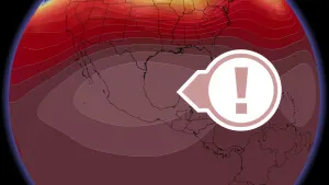
* WHAT...For the mountains, temperatures up to 99 expected. For theDavis Mountain Foothills, Marfa Plateau, and central BrewsterCounty, temperatures up to 104 expected. For Pecos and TerrellCounties, temperatures up to 108 expected. For lower BrewsterCounty, temperatures up to 112 expected.* WHERE...Central Brewster County, Lower Brewster County, Pecos, andTerrell Counties, and Chinati Mountains, Chisos Basin, DavisMountains, Davis Mountains Foothills, and Marfa Plateau.* WHEN...From noon today to 8 PM CDT this evening.* IMPACTS...The elderly, very young, sick, and people with heartconditions are most at risk in extreme heat.