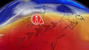
Alertes en vigueurBenchley, TX
THE NATIONAL WEATHER SERVICE HAS ISSUED SEVERE THUNDERSTORM WATCH248 IN EFFECT UNTIL 5 PM CDT THIS AFTERNOON FOR THE FOLLOWINGAREASIN TEXAS THIS WATCH INCLUDES 10 COUNTIESIN CENTRAL TEXASBELL CORYELL FALLSLAMPASAS LEON LIMESTONEMCLENNAN MILAM MILLSROBERTSONTHIS INCLUDES THE CITIES OF BUFFALO, CALVERT, CAMERON,CENTERVILLE, COPPERAS COVE, FORT CAVAZOS, FRANKLIN, GATESVILLE,GOLDTHWAITE, GROESBECK, HEARNE, JEWETT, KILLEEN, LAMPASAS,MARLIN, MEXIA, NORMANGEE, OAKWOOD, ROCKDALE, TEMPLE, AND WACO.
You should monitor later forecasts and be alert for possible FloodWarnings. Those living in areas prone to flooding should be preparedto take action should flooding develop.
* WHAT...Flooding caused by excessive rainfall continues to bepossible.* WHERE...Portions of north and central Texas including thefollowing counties, Bell, Bosque, Collin, Comanche, Coryell,Dallas, Denton, Ellis, Erath, Falls, Freestone, Hamilton, Hill,Hood, Jack, Johnson, Kaufman, Lampasas, Limestone, McLennan,Mills, Navarro, Palo Pinto, Parker, Rockwall, Somervell, Tarrant,Wise, Anderson, Henderson, Leon, Van Zandt, Milam, and Robertson.* WHEN...Through Friday morning.* IMPACTS...Excessive runoff may result in flooding of rivers,creeks, streams, and other low-lying and flood-prone locations.Flooding may occur in poor-drainage and urban areas. Low-watercrossings may become flooded.* ADDITIONAL DETAILS...- Rainfall totals of 1.5 to 3 inches, with isolated higheramounts up to 5 inches.