Alertes en vigueurEmad, LA
THE NATIONAL WEATHER SERVICE HAS ISSUED TORNADO WATCH 249 INEFFECT UNTIL 10 PM CDT THIS EVENING FOR THE FOLLOWING AREASIN LOUISIANA THIS WATCH INCLUDES 16 PARISHESIN CENTRAL LOUISIANAAVOYELLES EVANGELINE RAPIDESST. LANDRYIN SOUTH CENTRAL LOUISIANAIBERIA LAFAYETTE ST. MARTINST. MARYIN SOUTHWEST LOUISIANAACADIA ALLEN BEAUREGARDCALCASIEU CAMERON JEFFERSON DAVISVERMILIONIN WEST CENTRAL LOUISIANAVERNONIN TEXAS THIS WATCH INCLUDES 6 COUNTIESIN SOUTHEAST TEXASHARDIN JASPER JEFFERSONNEWTON ORANGE TYLERTHIS INCLUDES THE CITIES OF ABBEVILLE, ALEXANDRIA, BAYOU VISTA,BEAUMONT, BEAVER, BERWICK, BLEAKWOOD, BRANCH, BREAUX BRIDGE,BRIDGE CITY, BUNA, BUNDICK LAKE, BUNKIE, BURKEVILLE, BURNS POINT,CADE, CALL, CENTERVILLE, CHURCH POINT, COTTONPORT, CROWLEY,DE RIDDER, EFFIE, EUNICE, FARRSVILLE, FIELDS, FORKED ISLAND,FORT JOHNSON, FRANKLIN, FRED, GIST, HACKBERRY, HATHAWAY,HILLISTER, HOLLY SPRINGS, INTRACOASTAL CITY, IVANHOE, JAMESTOWN,JASPER, JENNINGS, JOHNSON BAYOU, KAPLAN, KINDER, KIRBYVILLE,LAFAYETTE, LAKE ARTHUR, LAKE CHARLES, LAWTELL, LEESVILLE,LUMBERTON, MAGNOLIA SPRINGS, MAMOU, MANSURA, MARKSVILLE, MEAUX,MORGAN CITY, MT. UNION, NEW IBERIA, NEWTON, OAKDALE, OPELOUSAS,ORANGE, ORETTA, PATTERSON, PICKERING, PINEVILLE, RAYNE, REDDELL,RICHARD, ROANOKE, SABINE PASS, SEA RIM STATE PARK, SILSBEE,SIMMESPORT, SLAGLE, SPURGER, ST. LANDRY, ST. MARTINVILLE,STEPHENSVILLE, SULPHUR, TOPSY, TOWN BLUFF, VIDOR, VILLE PLATTE,WARREN, WELSH, WIERGATE, AND WOODVILLE.
...The National Weather Service in Lake Charles LA has issued aFlood Warning for the following rivers in Louisiana...Bayou Des Cannes Near EuniceWhisky Chitto Creek Near MittieBayou Nezpique Near Basile...Forecast flooding changed from Minor to Moderate severity andincreased in duration for the following rivers in Texas...Village Creek Near Kountze...Forecast flooding changed from Minor to Moderate severity for thefollowing rivers in Louisiana...Texas...Sabine River Near BurkevilleNeches River Near EvadaleAdditional information is available at www.weather.gov.The next statement will be issued Friday morning at 1000 AM CDT.* WHAT...Minor flooding is forecast.* WHERE...Bayou Nezpique near Basile.* WHEN...From Saturday afternoon until further notice.* IMPACTS...At 22.0 feet, Minor agricultural flood damage will occur.* ADDITIONAL DETAILS...- At 9:15 AM CDT Thursday the stage was 19.5 feet.- Forecast...The river is expected to rise above flood stageSaturday afternoon and continue rising to 22.9 feet earlyTuesday morning. Additional rises are possible thereafter.- Flood stage is 22.0 feet.- http://www.weather.gov/safety/flood
...The National Weather Service in Lake Charles LA has issued aFlood Warning for the following rivers in Louisiana...Bayou Des Cannes Near EuniceWhisky Chitto Creek Near MittieBayou Nezpique Near Basile...Forecast flooding changed from Minor to Moderate severity andincreased in duration for the following rivers in Texas...Village Creek Near Kountze...Forecast flooding changed from Minor to Moderate severity for thefollowing rivers in Louisiana...Texas...Sabine River Near BurkevilleNeches River Near EvadaleAdditional information is available at www.weather.gov.The next statement will be issued Friday morning at 1000 AM CDT.* WHAT...Minor flooding is occurring and minor flooding is forecast.* WHERE...Whisky Chitto Creek near Mittie.* WHEN...From this morning until further notice.* IMPACTS...At 18.2 feet, Carpenter's Bridge Road is flooded.* ADDITIONAL DETAILS...- At 9:15 AM CDT Thursday the stage was 15.7 feet.- Recent Activity...The maximum river stage in the 24 hoursending at 9:15 AM CDT Thursday was 15.7 feet.- Forecast...The river is expected to rise to a crest of 18.0feet early tomorrow afternoon.- Flood stage is 15.0 feet.- http://www.weather.gov/safety/flood
You should monitor later forecasts and be prepared to take actionshould Flash Flood Warnings be issued.
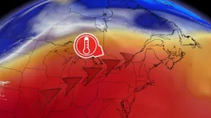
* WHAT...Flash flooding caused by excessive rainfall continues to bepossible.* WHERE...Portions of Louisiana, including the following parishes,Allen, Avoyelles, Beauregard, Evangeline, Lafayette, NorthernAcadia, Northern Calcasieu, Northern Jefferson Davis, Rapides,Southern Acadia, Southern Calcasieu, Southern Jefferson Davis, St.Landry, Upper St. Martin, Upper Vermilion and Vernon and southeastTexas, including the following areas, Hardin, Lower Jefferson,Northern Jasper, Northern Newton, Northern Orange, SouthernJasper, Southern Newton, Southern Orange, Tyler and UpperJefferson.* WHEN...Through Friday afternoon.* IMPACTS...Excessive runoff may result in flooding of rivers,creeks, streams, and other low-lying and flood-prone locations.Creeks and streams may rise out of their banks. Flooding may occurin poor drainage and urban areas.* ADDITIONAL DETAILS...- A storm system will slowly move through the region Thursdayand Friday. Widespread rainfall of 2 to 6 inches is possiblewith the potential for 6 to 12 inches locally. SoutheastTexas north of I-10 into south-central Louisiana has thehighest probability of seeing these higher totals. This willfall on already saturated soils and with ongoing flooding andor elevated water ways. Rainfall rates with the strongestshowers and storms will be in excess of 2 inches in one hour.Another round of showers and storms will be possible laterFriday into early Saturday, but confidence is too low toinclude in the watch at this time.- http://www.weather.gov/safety/flood
...The Flood Warning is extended for the following rivers inLouisiana...Texas...Bundick Creek At Bundick LakeMermentau River Near MermentauBayou Anacoco Near RosepinePine Island Bayou Near Sour Lake...The Flood Warning continues for the following rivers inLouisiana...Texas...Calcasieu River Near OakdaleCalcasieu River Near KinderCalcasieu River Near OberlinCalcasieu River Near Salt Water BarrierCalcasieu River near White Oak ParkCalcasieu River Near GlenmoraSabine River Near Bon WierSabine River Near DeweyvilleNeches River Near Town BluffNeches River at Neches River Saltwater BarrierAdditional information is available at www.weather.gov.The next statement will be issued Friday morning at 1000 AM CDT.* WHAT...Minor flooding is occurring and minor flooding is forecast.* WHERE...Calcasieu River near Kinder.* WHEN...Until further notice.* IMPACTS...At 19.5 feet, Lowland sections of Old Pump Road, KinderCemetery Road, and Nevils Bluff Road begin to flood.* ADDITIONAL DETAILS...- At 9:15 AM CDT Thursday the stage was 17.7 feet.- Recent Activity...The maximum river stage in the 24 hoursending at 9:15 AM CDT Thursday was 17.8 feet.- Forecast...The river is expected to rise to a crest of 19.0feet early Saturday afternoon.- Flood stage is 16.0 feet.- http://www.weather.gov/safety/flood
...The Flood Warning is extended for the following rivers inLouisiana...Texas...Bundick Creek At Bundick LakeMermentau River Near MermentauBayou Anacoco Near RosepinePine Island Bayou Near Sour Lake...The Flood Warning continues for the following rivers inLouisiana...Texas...Calcasieu River Near OakdaleCalcasieu River Near KinderCalcasieu River Near OberlinCalcasieu River Near Salt Water BarrierCalcasieu River near White Oak ParkCalcasieu River Near GlenmoraSabine River Near Bon WierSabine River Near DeweyvilleNeches River Near Town BluffNeches River at Neches River Saltwater BarrierAdditional information is available at www.weather.gov.The next statement will be issued Friday morning at 1000 AM CDT.* WHAT...Moderate flooding is occurring and moderate flooding isforecast.* WHERE...Calcasieu River near Oberlin.* WHEN...Until further notice.* ADDITIONAL DETAILS...- At 9:15 AM CDT Thursday the stage was 15.8 feet.- Recent Activity...The maximum river stage in the 24 hoursending at 9:15 AM CDT Thursday was 15.9 feet.- Forecast...The river will rise to 16.5 feet tomorrow evening.It will then fall Saturday evening. It will rise to 17.0 feetearly Tuesday morning. It will then fall again but remainabove flood stage.- Flood stage is 13.0 feet.- http://www.weather.gov/safety/flood
...The Flood Warning is extended for the following rivers inLouisiana...Texas...Bundick Creek At Bundick LakeMermentau River Near MermentauBayou Anacoco Near RosepinePine Island Bayou Near Sour Lake...The Flood Warning continues for the following rivers inLouisiana...Texas...Calcasieu River Near OakdaleCalcasieu River Near KinderCalcasieu River Near OberlinCalcasieu River Near Salt Water BarrierCalcasieu River near White Oak ParkCalcasieu River Near GlenmoraSabine River Near Bon WierSabine River Near DeweyvilleNeches River Near Town BluffNeches River at Neches River Saltwater BarrierAdditional information is available at www.weather.gov.The next statement will be issued Friday morning at 1000 AM CDT.* WHAT...Minor flooding is forecast.* WHERE...Calcasieu River near Oakdale.* WHEN...Until further notice.* IMPACTS...At 17.0 feet, Minor lowland flooding, mainly forestedareas along the river will occur. Park and picnic ground off ofHighway 10 begins to flood.* ADDITIONAL DETAILS...- At 8:30 AM CDT Thursday the stage was 16.4 feet.- Forecast...The river is expected to rise above flood stageearly Saturday morning and continue rising to a crest of 18.0feet Sunday morning.- Flood stage is 17.0 feet.- http://www.weather.gov/safety/flood